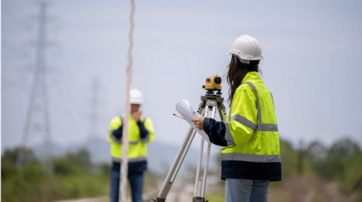
Boundary disputes are a common issue in property management and ownership, often arising from disagreements between neighboring landowners over the precise location of property lines. Such disputes can lead to legal conflicts, financial losses, and significant stress for those involved. Addressing these issues effectively requires professional intervention, and a boundary disputes surveyor plays a crucial role in resolving these conflicts. This article explores the nature of boundary disputes and how surveyors can help settle property boundaries.
The Nature of Boundary Disputes
Boundary disputes typically arise when there is a lack of clarity or agreement on the exact limits of property ownership. These disputes can stem from various issues, including:
- Ambiguous Property Descriptions: Property deeds or maps may contain vague or outdated descriptions that make it difficult to determine exact boundaries.
- Encroachments: Physical intrusions, such as fences, buildings, or landscaping that extend into a neighboring property, can lead to disputes.
- Historical Changes: Changes in land use, natural shifts, or errors in previous surveys can alter the understanding of property boundaries.
- Legal Conflicts: Disagreements may also arise from differing interpretations of legal documents or conflicting claims to ownership.
Such disputes can become complex and contentious, often requiring legal resolution and professional expertise to clarify and resolve.
The Role of a Boundary Disputes Surveyor
A boundary disputes surveyor is a specialized professional trained to assess, measure, and establish property boundaries with precision. Their expertise is invaluable in resolving disputes and ensuring that property boundaries are accurately defined. Key functions of a boundary disputes surveyor include:
1. Conducting Detailed Surveys
A boundary disputes surveyor conducts comprehensive surveys of the property in question. Using advanced tools and techniques, such as GPS and laser scanning, the surveyor collects precise measurements and data to accurately determine property lines. This process involves:
- Reviewing Historical Records: The surveyor examines historical documents, including property deeds, maps, and previous survey reports.
- On-Site Measurements: Accurate field measurements are taken to establish the current state of property boundaries.
- Identification of Landmarks: Natural or man-made landmarks that may impact boundary lines are identified and recorded.
2. Interpreting Legal Documents
Surveyors are skilled in interpreting complex legal documents related to property ownership and boundaries. They analyze:
- Property Deeds: Understanding the language and terms used in deeds to determine the intended boundaries.
- Historical Maps: Comparing historical maps with current measurements to identify discrepancies or changes over time.
- Legal Descriptions: Clarifying legal descriptions that may be ambiguous or outdated.
3. Providing Expert Testimony
In cases where boundary disputes escalate to legal proceedings, a boundary disputes surveyor can provide expert testimony. Their role includes:
- Presenting Evidence: The surveyor presents their findings, including survey data and historical documents, to the court.
- Explaining Technical Details: They explain complex technical details in a clear and understandable manner for judges and juries.
- Offering Professional Opinions: The surveyor provides professional opinions on the most accurate representation of property boundaries.
Resolving Boundary Disputes
The involvement of a boundary disputes surveyor can facilitate the resolution of boundary disputes through various means:
1. Mediation and Negotiation
Surveyors often assist in mediation and negotiation between disputing parties. By providing clear, objective data, they help parties reach an amicable agreement without the need for prolonged legal battles.
2. Clarifying Property Boundaries
The surveyor’s findings can lead to a clear definition of property boundaries, allowing for the correction of encroachments or inaccuracies. This may involve:
- Adjusting Property Lines: Making necessary adjustments to align with the survey results.
- Resolving Encroachments: Addressing and rectifying any physical intrusions that affect property boundaries.
3. Legal Documentation
The surveyor’s report and findings can be used to update legal documents, such as property deeds, to reflect accurate boundary lines. This ensures that future disputes are less likely to arise due to unclear or outdated boundary descriptions.
Conclusion
Boundary disputes can be complex and stressful, but the expertise of a boundary disputes surveyor is instrumental in resolving these issues. Through detailed surveys, legal document interpretation, and expert testimony, surveyors provide clarity and precision in defining property boundaries. Their involvement not only helps settle disputes but also prevents future conflicts, ensuring that property ownership and use are clearly understood and legally supported. For anyone facing a boundary dispute, consulting a qualified boundary disputes surveyor is a crucial step towards achieving a fair and accurate resolution.


